
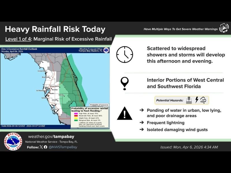
Today: Florida Faces Marginal Flood Risk With Widespread Afternoon Storms, Urban Flooding Concerns, Lightning and Gusty Winds Possible
FLORIDA — A new round of unsettled weather is expected to develop across parts of the state today, with forecasters highlighting a Level 1 out of 4 marginal risk for excessive rainfall, especially across interior sections of West Central and Southwest Florida. While the overall risk remains on the lower end, conditions will still support scattered to widespread showers and thunderstorms through the afternoon and evening hours.
Storms Expected to Build Through the Afternoon and Evening
Weather patterns indicate that instability will increase as the day progresses, allowing storms to develop and expand across inland areas. These storms are expected to become more widespread by late afternoon into the evening, bringing periods of moderate to locally heavy rainfall.
Although coastal areas may see less intense rainfall compared to inland regions, many communities across central and southwestern Florida will still experience passing showers and thunderstorms.
Where the Greatest Impact Is Expected
The primary focus area includes interior portions of West Central and Southwest Florida, where moisture and daytime heating will combine to fuel storm development. These areas are more likely to experience repeated rounds of rainfall, increasing the risk for localized flooding issues.
Meanwhile, rainfall across the Gulf side is expected to be lighter compared to regions farther east, where heavier totals are more likely to develop over time.
Flooding Concerns Remain Limited but Notable
Despite the marginal classification, localized flooding cannot be ruled out. The biggest concern will be ponding of water in urban and low-lying areas, especially in places with poor drainage systems.
Heavy downpours occurring in a short period of time could lead to water accumulation on roads and streets, particularly during peak storm activity in the late afternoon and evening.
Additional Hazards: Lightning and Gusty Winds
In addition to heavy rain, storms may bring frequent lightning and isolated damaging wind gusts. While widespread severe weather is not expected, a few stronger storms could still produce brief periods of gusty winds capable of minor damage. Residents are advised to remain weather aware during the afternoon hours, especially if outdoor plans are scheduled.
East Coast Likely to See Heavier Totals This Week
Looking beyond today, the overall rainfall trend suggests that heavier accumulations will favor Florida’s East Coast, while Gulf-side locations may continue to see comparatively lower totals.
Even so, inland areas across the state will still receive beneficial rainfall throughout the week, though not evenly distributed.
Bottom Line
Today’s setup brings a low-end but active storm pattern, with scattered to widespread thunderstorms capable of producing localized flooding, lightning, and gusty winds. While not a high-risk event, the combination of moisture and storm coverage means impacts could still be felt in multiple areas. Stay with NapervilleLocal.com for continued updates as conditions evolve throughout the day.

I’ve lived in Naperville long enough to see how quickly our community changes — from new developments downtown to sudden shifts in our Midwest weather. Reporting on Naperville news and daily forecasts gives me the chance to keep neighbors informed about what really matters. My goal is simple: deliver clear, timely updates so you always know what’s happening in our city and what to expect from the skies above.