
This Week’s Weather Feels Nothing Like April: Relentless Near-90°F Heat, Deepening Drought, and Wildfire Danger Grip the Southeast From Tuesday Through Sunday
SOUTHEAST — Forget April — this week across the Southeast is borrowing straight from July’s playbook. A deeply abnormal heat pattern is locking in near-90-degree temperatures from Tuesday all the way through Sunday, combining with dangerously dry conditions to push an already struggling drought into potentially historic territory and raise serious wildfire concerns across the region. A cold front arrives Sunday with promises of storms, but forecasters warn it may not deliver the relief the parched landscape is desperately crying out for.
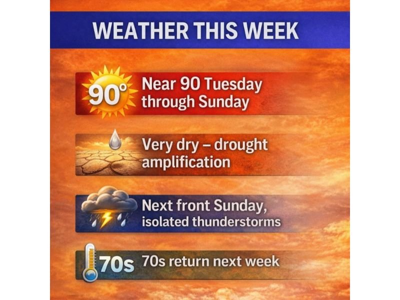
Six Straight Days of Near-90°F Heat Starting Tuesday
The week’s story is simple and relentless — near 90°F temperatures are locked in Tuesday through Sunday with virtually no day-to-day relief in sight. The pattern carries a July-like feel, with one notable difference from true summer: humidity levels will run below normal. That might sound like good news, but it is actually the opposite — lower humidity combined with intense heat creates far more dangerous drought and wildfire conditions than a humid heat event would.
Residents should prepare for six consecutive days of afternoon heat that simply has no place on an April calendar across the Southeast.
Drought Conditions Worsening by the Day
The heat is arriving on top of drought conditions that are already established and deteriorating. A full week of near-90-degree temperatures will drive rapid evaporation, stress vegetation to its limits, and drain whatever soil moisture remains from earlier rainfall.
Forecasters are blunt about the outlook — some areas could be pushed into the highest drought categories in the near term if this pattern plays out as expected. Water resources, agricultural operations, and the broader landscape will all feel the compounding weight of heat and dryness stacking up day after day.
Wildfire Risk Rises as the Week Progresses
Dry vegetation, low afternoon humidity, and baking temperatures create a dangerous recipe for wildfire. The risk will build progressively through the week, with the most acute fire weather conditions expected during peak heating hours each afternoon.
Residents across the region should avoid all outdoor burning without exception and stay alert to any activity that could spark a fire in the increasingly parched landscape surrounding their communities.
Sunday’s Cold Front Offers Hope — But With Limitations
A cold front pushing through on Sunday will trigger isolated downpours and thunderstorms, offering a brief window of hope for drought relief. However, forecasters are managing expectations carefully — fast-moving frontal storms tend to deliver heavy but very brief rainfall that runs off baked, hardened ground rather than soaking in where it is truly needed.
Following the front, temperatures drop back into the more seasonable 70s to open the following week — welcome relief after an exhausting stretch of abnormal heat. Stay with NapervilleLocal.com for the latest weather updates and local forecast coverage.

I’ve lived in Naperville long enough to see how quickly our community changes — from new developments downtown to sudden shifts in our Midwest weather. Reporting on Naperville news and daily forecasts gives me the chance to keep neighbors informed about what really matters. My goal is simple: deliver clear, timely updates so you always know what’s happening in our city and what to expect from the skies above.