
Alabama Faces Weekend Cold Front With Light Rainfall Under 0.25 Inches, No Severe Weather Risk as Record Highs Possible Through Friday
ALABAMA — A First Alert Weather Update is in effect as a cold front approaches the region this weekend, bringing the first chance of meaningful rain in some time. While the rainfall will not be enough to end the ongoing drought, forecasters say any precipitation is welcome. No severe weather concerns are expected with this system.
Record-Breaking Heat Possible Before the Front Arrives
Before the weekend rain arrives, temperatures will surge through the week. Highs are expected to reach the mid-80s today and tomorrow, climbing further into the upper 80s by Friday. A few spots across Alabama could even touch 90°F, and record high temperatures may be set at some locations. Mornings will remain pleasant, but afternoons will heat up quickly, with a steady south wind keeping conditions breezy throughout the period.
Showers Sneak Into Northwest Alabama Late Friday
A few showers may push into far northwest Alabama late tomorrow ahead of the main system, though most of the state will remain dry until Saturday. The bulk of the rain is tied to a cold front expected to arrive Saturday late evening and push through overnight, bringing the most widespread shower chances of the entire week to the region.
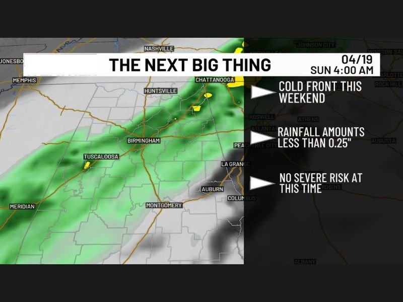
Rainfall Totals Expected to Stay Light
Despite the drought conditions, rainfall totals from this system are expected to remain modest. Most areas will see less than a quarter inch of rain, with only a few spots potentially picking up around that amount. While it will not make a significant dent in drought conditions, the rain is still a welcome development for a region that has been running dry.
No Severe Weather Threat With This System
Forecasters are not raising any severe weather concerns with the approaching cold front at this time. The system is expected to bring plain rain showers rather than thunderstorm activity, keeping the overall risk profile low for the weekend. Residents can expect a wet but manageable Saturday night without the threat of damaging winds, hail, or tornadoes.
Cooler Air Returns Early Next Week
Behind the departing front, temperatures will drop noticeably heading into early next week. Morning lows are expected to fall back into the 40s, marking a significant shift after the near-record heat of the preceding days. Forecasters do not anticipate any frost concerns despite the cooler readings, so outdoor plants and gardens should remain safe through the transition. Stay with NapervilleLocal.com for the latest weather updates and local forecast coverage.

I’ve lived in Naperville long enough to see how quickly our community changes — from new developments downtown to sudden shifts in our Midwest weather. Reporting on Naperville news and daily forecasts gives me the chance to keep neighbors informed about what really matters. My goal is simple: deliver clear, timely updates so you always know what’s happening in our city and what to expect from the skies above.