
Thundershowers Possible Across All of Kentucky Including Louisville, Lexington, and Paducah Friday Afternoon and Evening With No Significant Severe Threat Expected
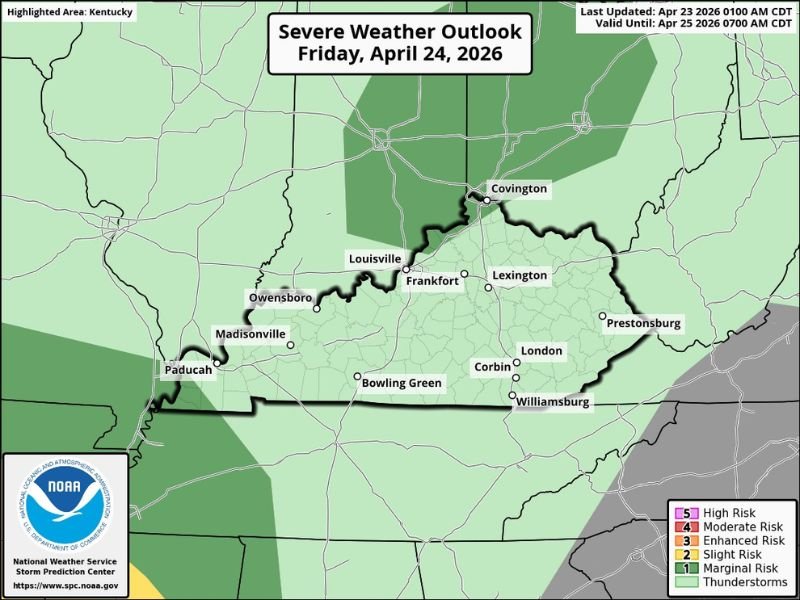
KENTUCKY — Thundershowers are possible across the entire state of Kentucky this Friday April 24, 2026 during the afternoon and evening hours, with the Severe Weather Outlook valid through April 25 placing Kentucky within the general thunderstorm zone.
No real severe weather threat is expected with Friday’s activity, though very small hail and an occasional gust of wind are possible with the stronger cells. Coverage will be scattered and spotty, making it difficult to predict exactly who will see a heavy downpour and who will stay dry through the afternoon and evening.
Statewide Thundershower Chances Friday Afternoon and Evening
The NWS Storm Prediction Center Severe Weather Outlook for Friday April 24 shows the entire state of Kentucky highlighted within the general thunderstorm zone, covering all major communities including Louisville, Lexington, Frankfort, Covington, Owensboro, Madisonville, Paducah, Bowling Green, Corbin, London, Prestonsburg, and Williamsburg.
The thunderstorm activity is expected to develop during the afternoon hours and continue into the evening, with timing varying across different parts of the state as individual cells develop and move through the region.
No Significant Severe Threat With Friday’s Storms
Unlike the significant severe weather events impacting other parts of the country this week, Friday’s Kentucky thundershowers carry no real severe weather designation. The threat level remains at the general thunderstorm category, well below the Marginal, Slight, or Enhanced risk levels that would indicate organized severe weather potential.
Any impacts from Friday’s storms will be very limited, with very small hail and an occasional gusty wind being the extent of what the stronger cells might produce. Residents can go about their normal Friday plans with reasonable confidence that significant severe weather will not be a factor across the state.
Scattered Coverage Makes Rainfall Distribution Unpredictable
One notable characteristic of Friday’s thundershower activity is the highly scattered and localized nature of storm coverage expected across Kentucky. With storm cells being small and widely spaced, there will be significant variability in who receives a heavy downpour and who misses the rain entirely even within the same county or city.
This scattered coverage means that while thundershowers are possible statewide, no single location should count on seeing rainfall Friday, and outdoor plans do not necessarily need to be cancelled given the low overall threat level and spotty nature of the expected activity. Stay with NapervilleLocal.com for the latest weather updates and local forecast coverage.

I’ve lived in Naperville long enough to see how quickly our community changes — from new developments downtown to sudden shifts in our Midwest weather. Reporting on Naperville news and daily forecasts gives me the chance to keep neighbors informed about what really matters. My goal is simple: deliver clear, timely updates so you always know what’s happening in our city and what to expect from the skies above.