
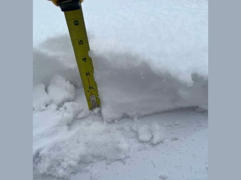
4 Inches Already Falling in Cheyenne by 7AM With Bad Roads in Estes Park as Northern Front Range Switches to Wet Snow Early Wednesday Morning
COLORADO — A significant and earlier than expected snow changeover is already underway across the northern Front Range and Cheyenne corridor as of 7 AM Wednesday, May 6, 2026. Cheyenne is already reporting 4 inches of snow on the ground, and most of the northern Front Range has switched over from rain to wet snowfall. Bad road conditions are already being reported out of Estes Park, with the earlier than anticipated changeover raising serious concerns about accumulation along the Front Range, I-25 corridor, and eastern plains.
4 Inches Already Down in Cheyenne With Northern Front Range Switched to Wet Snow
Cheyenne reached 4 inches by 7 AM, confirming the storm is performing at the higher end of early expectations. The earlier changeover from rain to snow across the northern Front Range is creating a more impactful situation than originally anticipated for communities along and east of I-25.
The wet and heavy nature of the snow is increasing risk for tree damage, downed power lines, and hazardous road surfaces across all affected areas through the morning hours.
Bad Roads Already Reported in Estes Park With More Accumulation Building
Road conditions in Estes Park are already bad as of the 7 AM update, consistent with the area’s elevation and exposure to the heaviest early snowfall. Travel across mountain corridors and higher elevation roads should be considered extremely hazardous through Wednesday.
The earlier than expected changeover makes accumulation forecasting more uncertain and potentially more impactful for lower elevation Front Range communities.
Front Range and I-25 Corridor Watched Closely as Earlier Changeover Raises Stakes
The early changeover is being watched very carefully as accumulation potential along the I-25 corridor and eastern plains becomes clearer through the day. The earlier snow arrives at lower elevations, the greater the accumulation potential on roads, trees, and surfaces through Wednesday afternoon. Stay with NapervilleLocal.com for the latest weather updates and local forecast coverage.

I’ve lived in Naperville long enough to see how quickly our community changes — from new developments downtown to sudden shifts in our Midwest weather. Reporting on Naperville news and daily forecasts gives me the chance to keep neighbors informed about what really matters. My goal is simple: deliver clear, timely updates so you always know what’s happening in our city and what to expect from the skies above.