
Flood Watch Through Late Tonight With Flash Flood Threat From Heavy Downpours Across North Georgia Including Atlanta, Cobb, Cherokee, Rome, and Gainesville After 4 Inches in 72 Hours
NORTH GEORGIA — A Flood Watch is active through late tonight across north Georgia as another round of very heavy downpours is expected to develop later Monday, May 25, 2026, on top of already saturated ground that has absorbed over 4 inches of rainfall across much of the north metro area in the last 72 hours. Parts of Cobb and Cherokee counties received that much rain in a single storm Sunday evening alone, triggering flash flooding, and the threat for street and small stream flooding continues through tonight as additional heavy rain arrives.
Over 4 Inches in 72 Hours Already Recorded Across North Metro Atlanta Corridor
The 72-hour rainfall total maps show widespread red and yellow signatures blanketing north Georgia, with the heaviest concentrations centered across the north Atlanta metro including Cobb, Cherokee, Woodstock, Acworth, Marietta, Roswell, and Sandy Springs. Some of the most intense totals on the zoomed-in rainfall map show deep red cores across the Woodstock, Acworth, and Roswell corridor indicating the highest accumulations from the multi-day event.
Parts of Cobb and Cherokee counties recorded over 4 inches in a single storm during Sunday evening, a staggering amount that immediately overwhelmed drainage systems and triggered flash flooding across streets and small streams. The ground across the entire north metro zone is now fully saturated with virtually no capacity remaining to absorb any additional rainfall.
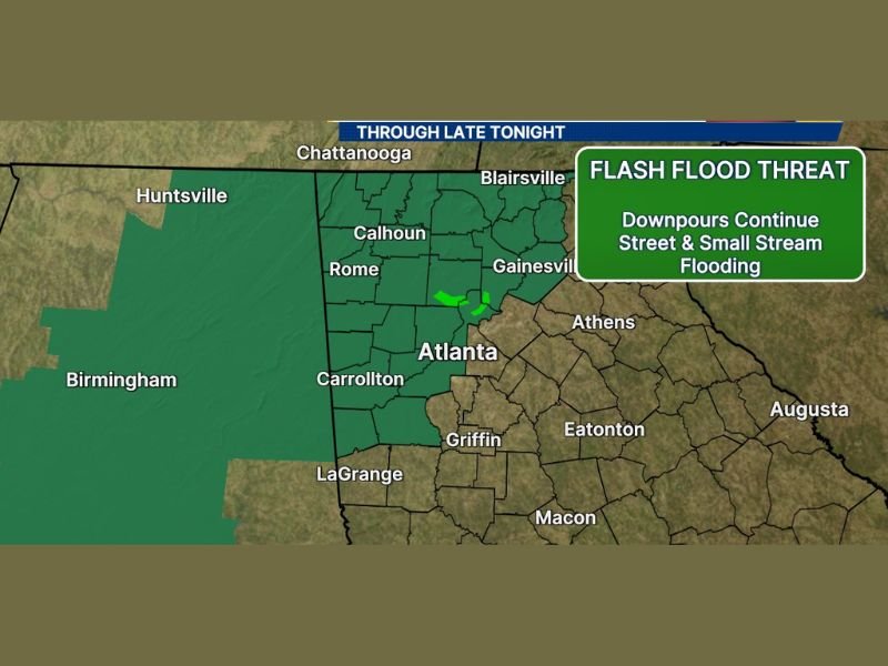
Flash Flood Threat Continues With Downpours, Street Flooding, and Small Stream Flooding
The active Flash Flood Threat encompasses the entire north Georgia Flood Watch zone through late tonight, with continued heavy downpours capable of producing rapid street flooding and small stream overflow across the affected corridor. The combination of saturated ground and additional heavy rainfall arriving Monday creates a dangerous and compounding flood situation for communities from Rome and Calhoun through Gainesville and Atlanta.
Street flooding and small stream flooding are the identified primary hazard modes for today’s ongoing threat. Any location that experienced flooding during Sunday evening’s storms should remain on high alert as conditions could deteriorate quickly and rapidly once new heavy rain begins developing later today.
Flood Watch Covers Broad Corridor From Rome and Blairsville Through Atlanta and Carrollton
The active Flood Watch stretches across a broad zone covering north and central Georgia from the Chattanooga border area southward through Rome, Calhoun, Gainesville, and Atlanta, extending westward through Carrollton and southward toward Griffin and LaGrange. This wide watch area reflects the broad geographic extent of the flooding risk tied to both the prior rainfall accumulation and the incoming storm round.
Residents across the entire Flood Watch zone should avoid any unnecessary travel once heavy rain begins developing later today. Never attempt to drive through flooded roadways regardless of how shallow the water appears, as just a few inches of moving water can sweep a vehicle off the road. Stay with NapervilleLocal.com for the latest weather updates and local forecast coverage.

I’ve lived in Naperville long enough to see how quickly our community changes — from new developments downtown to sudden shifts in our Midwest weather. Reporting on Naperville news and daily forecasts gives me the chance to keep neighbors informed about what really matters. My goal is simple: deliver clear, timely updates so you always know what’s happening in our city and what to expect from the skies above.