
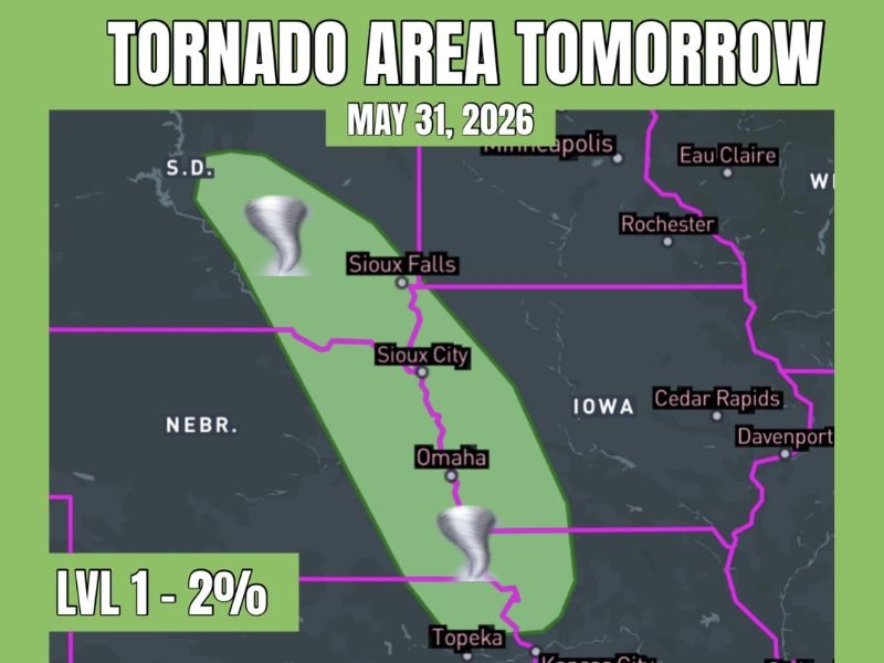
Tornado Risk With Hail and Wind Threats Targeting Eastern Nebraska and Far Western Iowa Including Omaha, Sioux City, and Sioux Falls at Level 1 Sunday May 31
EASTERN NEBRASKA AND FAR WESTERN IOWA — A tornado risk is in place for eastern Nebraska and far western Iowa on Sunday, May 31, 2026, as a weak low pivots eastward following tonight’s storm activity and sets up the next round of organized severe weather across the corridor. The risk carries a Level 1 designation with a 2 percent tornado probability, with hail and wind identified as the primary severe hazard modes while outflow boundaries from tonight’s storms could enhance the tornado potential further depending on how they set up across the region by Sunday.
Weak Low Pivoting East After Tonight’s Storms Sets Up Sunday’s Organized Severe Threat
The setup for Sunday’s tornado risk begins with tonight’s storm activity, as a weak low pressure system pivots eastward and positions favorable wind shear and instability across the eastern Nebraska and far western Iowa corridor. This type of outflow boundary enhancement scenario is common in late May and can significantly increase tornado probability beyond what models show the day before.
Forecasters note the outflow boundary wildcard means the actual tornado threat Sunday could be higher than the current 2 percent if boundaries set up favorably across the risk zone. Monitoring updated forecasts through the day Saturday and into Sunday morning will be critical for residents across the corridor.
Hail and Wind Primary Hazard Modes With Brief Tornado Possible Across the Risk Zone
Large hail and damaging winds are the highest probability severe hazards across the Level 1 risk zone stretching from southern South Dakota through Sioux Falls, Sioux City, Omaha, and toward the Kansas border. These hazards will accompany any organized severe storm that develops across the corridor Sunday and should be the baseline expectation for communities within the risk area.
The tornado threat sits at 2 percent but remains real enough to warrant shelter plan preparation for all residents from Sioux Falls southward through Omaha before Sunday afternoon arrives.
Risk Zone Runs From South Dakota Through Eastern Nebraska Into Kansas Border Sunday
The outlined tornado risk zone covers a narrow but elongated corridor from southern South Dakota through Sioux Falls, Sioux City, and Omaha extending toward Topeka and the Kansas border. All communities within this zone should remain weather aware through Sunday afternoon and evening with a shelter plan ready before storms develop. Stay with NapervilleLocal.com for the latest weather updates and local forecast coverage.

I’ve lived in Naperville long enough to see how quickly our community changes — from new developments downtown to sudden shifts in our Midwest weather. Reporting on Naperville news and daily forecasts gives me the chance to keep neighbors informed about what really matters. My goal is simple: deliver clear, timely updates so you always know what’s happening in our city and what to expect from the skies above.