
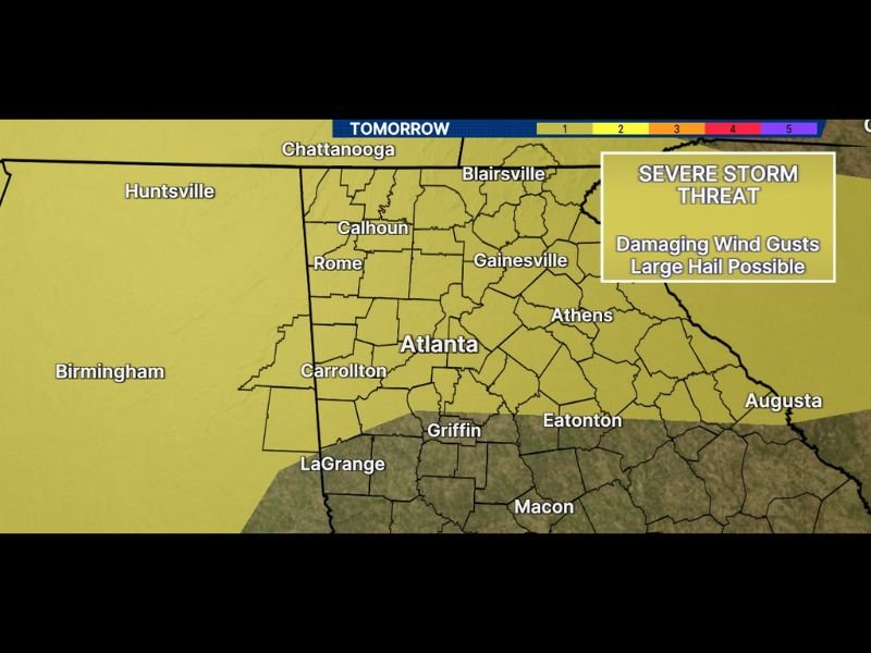
Severe Storm Threat With Damaging Wind Gusts, Large Hail, and Flash Flooding Risk Targeting North and Central Georgia Including Atlanta, Rome, and Gainesville Monday June 1
NORTH AND CENTRAL GEORGIA — A severe storm threat is arriving across north and central Georgia on Monday, June 1, 2026, as storms move in from the northwest bringing damaging wind gusts and large hail as the primary hazards. The overall threat is low and not everyone will be impacted, but locally strong storms capable of downing trees on wetter soils and producing flash flooding where the heaviest rain falls will make Monday a day that requires weather awareness across the entire risk corridor.
Storms Moving in From the Northwest Monday With Damaging Winds and Large Hail
The incoming storm system is tracking from the northwest, bringing organized storm energy into the north Georgia corridor through Monday. Damaging wind gusts are the headline hazard, with trees already at elevated risk of falling due to soils that remain wet and saturated from recent heavy rainfall events across the region.
The severe threat zone covers a broad corridor from the Chattanooga border and Blairsville southward through Rome, Calhoun, Gainesville, and Atlanta, extending toward Carrollton, Griffin, LaGrange, and Macon in the south. The risk area encompasses a heavily populated zone that includes the entire Atlanta metro and surrounding north Georgia communities.
Flash Flooding Remains a Real Concern Where Heaviest Rain Falls Monday
Beyond the wind and hail threats, flash flooding continues to be a risk wherever the heaviest rainfall concentrates across north and central Georgia on Monday. Ground saturation from prior rainfall events significantly reduces the amount of new rain needed to trigger flash flooding across the region, meaning even a moderate downpour could produce rapid water rises in flood-prone areas.
Residents across the Athens, Augusta, and Eatonton corridor on the eastern edge of the risk zone should remain particularly aware of flooding potential Monday given their proximity to areas that have already seen significant recent rainfall accumulation.
Low Overall Threat but Locally Strong Storms Possible Across the Atlanta Metro Monday
While the broad severe weather probability remains low and not every community will see impactful storm activity, the locally strong nature of individual cells that do develop means preparedness is still essential. Staying connected to local alerts, avoiding flooded roadways, and securing any loose outdoor items before Monday’s storm window arrives are the most important actions for residents across the risk zone. Stay with NapervilleLocal.com for the latest weather updates and local forecast coverage.

I’ve lived in Naperville long enough to see how quickly our community changes — from new developments downtown to sudden shifts in our Midwest weather. Reporting on Naperville news and daily forecasts gives me the chance to keep neighbors informed about what really matters. My goal is simple: deliver clear, timely updates so you always know what’s happening in our city and what to expect from the skies above.