
Quieter Sunday Before Strong to Severe Storms With Damaging Winds, Large Hail, and Tornadoes Return Along and East of I-25 From Wyoming Through Colorado
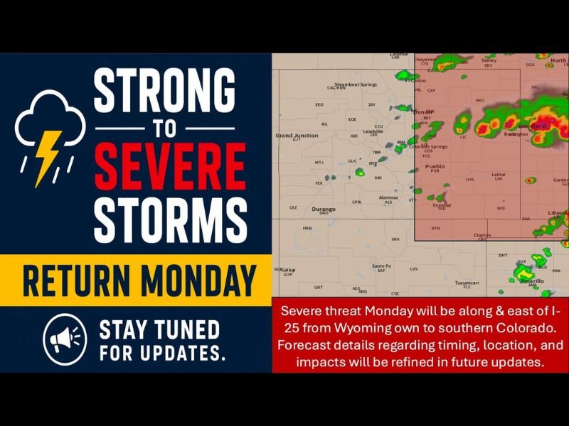
COLORADO AND SURROUNDING REGION — Sunday, May 31, 2026, brings a relatively quieter day across Colorado and the surrounding region with a mix of 70s and 80s statewide, isolated showers, and gusty winds possible with any storm that forms. However, Monday brings a significant increase in severe weather potential along and east of I-25 from Wyoming southward through Colorado and into western Kansas, where all modes of severe weather are possible including damaging winds, large hail, and tornadoes during the afternoon and evening hours.
Sunday Mostly Uneventful With Isolated Storms and Gusty Winds Across Multiple Zones
The Front Range and I-25 corridor will be partly sunny and pleasant Sunday with highs in the upper 70s to low 80s and only isolated afternoon showers and storms. The eastern plains will be the warmest zone pushing near 90 degrees on the far east with mostly sunny skies and only a few late-day storm possibilities.
Mountains and foothills will see isolated PM showers and storms with frequent lightning possible across the higher terrain, highs of 50s to 70s, and cooler conditions in the high country. The western slope stays mostly sunny with highs reaching the upper 70s to mid 80s and a beginning warming trend through the day.
Monday Severe Threat Developing Along and East of I-25 From Wyoming Through Colorado
Monday’s severe weather threat will focus along and east of I-25 from Wyoming southward through Colorado and into western Kansas, with all severe modes on the table including damaging winds, large hail, and tornadoes. The radar simulation shows active storm development already underway across the Denver through Goodland corridor with intense cores developing across northeastern Colorado and western Kansas.
Timing, exact location, and specific impacts will be refined in future forecast updates as Monday’s setup comes into sharper focus through Sunday.
Active Pattern Continues Through the Week With Isolated Storms Wednesday Through Saturday
Temperatures trend above normal Monday through Tuesday before isolated afternoon storms return Wednesday through Thursday. The Friday through Saturday period brings partly sunny skies with spotty storms possible in a typical early June pattern across the region through the coming weekend. Stay with NapervilleLocal.com for the latest weather updates and local forecast coverage.

I’ve lived in Naperville long enough to see how quickly our community changes — from new developments downtown to sudden shifts in our Midwest weather. Reporting on Naperville news and daily forecasts gives me the chance to keep neighbors informed about what really matters. My goal is simple: deliver clear, timely updates so you always know what’s happening in our city and what to expect from the skies above.