
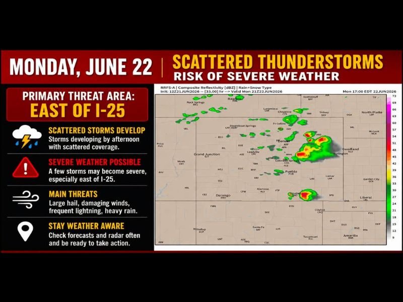
Severe Storms Bring Large Hail Damaging Winds and Isolated Tornadoes to Colorado Eastern Plains and Western Kansas Monday With Active Pattern Continuing All Week
COLORADO — An active and potentially dangerous weather week is underway across Colorado and into western Kansas and Nebraska, with severe thunderstorms possible each afternoon and evening through the coming days. Today’s primary threat is focused east of Interstate 25 on the eastern plains, where storms are expected to fire up around 1 p.m., first developing in the foothills before intensifying as they push onto the plains.
Large hail, damaging winds, and brief tornadoes are all possible with the strongest cells today. Shortwave disturbances riding a zonal flow pattern will continue fueling daily storm chances through the entire week.
Eastern Plains Face Greatest Severe Weather Risk Today
The eastern plains of Colorado, along with western Nebraska and western Kansas, carry the highest storm coverage and greatest severe weather risk for Monday. Hail, damaging winds, and isolated tornadoes are all on the table, with storms expected to become most intense once they move off the foothills and onto the open plains during the afternoon hours.
Storms Fire Along I-25 Corridor Before Intensifying
Storm development is expected to begin near the foothills and along portions of Interstate 25 around 1 p.m. before growing and organizing as they push east. Rogue outflow boundaries generated by early storms could trigger additional development in unexpected locations, making close monitoring of radar essential throughout the afternoon.
Western Slope Stays Hot and Dry While Mountains See Daily Storms
The Western Slope will remain hot and mostly dry through the week, with only isolated high-terrain storms possible and fire weather concerns continuing. The mountains and Continental Divide will see the most frequent daily afternoon storms, with locally heavy rain and lightning a concern at higher elevations.
Active Pattern Expected Through the Entire Week
Tuesday and Wednesday carry a complicated and evolving severe weather setup, with the pattern becoming increasingly uncertain heading into Thursday and beyond. Residents across all regions are urged to check forecasts each morning and monitor radar updates throughout the afternoon as conditions develop.
Stay with NapervilleLocal.com for the latest weather updates and local forecast coverage.

I’ve lived in Naperville long enough to see how quickly our community changes — from new developments downtown to sudden shifts in our Midwest weather. Reporting on Naperville news and daily forecasts gives me the chance to keep neighbors informed about what really matters. My goal is simple: deliver clear, timely updates so you always know what’s happening in our city and what to expect from the skies above.