
Rain and Storms Firing Across Central and Western Florida Including Tampa Orlando Naples and Miami With Coverage Spreading Northward Into Georgia Through Sunday Afternoon
FLORIDA — Rain and storms are firing across central and western portions of the Florida peninsula Sunday, fueled by a classic Atlantic high pushing Gulf sea breeze moisture inland. Southern areas including Naples, Miami, and Tampa are seeing the earliest activity starting late morning into early afternoon, with coverage expanding northward through Orlando, Gainesville, and into Georgia through the middle to late afternoon hours. The storm line is concentrated along the western peninsula corridor with heavy rainfall and frequent lightning across the most active cells.
Southern Florida Sees First Round of Storms Late Morning Into Early Afternoon
The southern portion of the Florida peninsula including Naples, Fort Myers, Miami, and the Keys is experiencing the earliest storm development today as the Gulf sea breeze fires up ahead of the broader coverage. These initial cells are producing heavy rainfall and lightning across the southwest coast corridor during the late morning and early afternoon window.
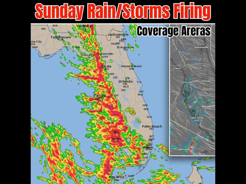
The coverage map shows the most intense radar returns concentrated from Naples northward through Tampa and into the Ocala corridor during this opening phase.
Storm Coverage Expands Through Tampa Orlando and Gainesville Through Mid to Late Afternoon
As the afternoon progresses, storm coverage expands northward and eastward through Tampa, Orlando, Gainesville, Cross City, and into the Georgia border region near Valdosta. The Gulf sea breeze boundary continues pushing inland, triggering new storm development along its leading edge through the middle and later afternoon hours.
Communities along the western spine of the Florida peninsula from Tampa southward through Naples face the highest coverage and most persistent storm activity through the afternoon.
Georgia Border Region Including Valdosta Sees Storms as Coverage Pushes North
The northward extent of today’s storm activity is reaching into southern Georgia with Valdosta already seeing activity on the northern fringe of the coverage area. Residents from central Florida northward through the Georgia state line should expect storm chances to continue building through the late afternoon and early evening hours today. Stay with NapervilleLocal.com for the latest weather updates and local forecast coverage.

I’ve lived in Naperville long enough to see how quickly our community changes — from new developments downtown to sudden shifts in our Midwest weather. Reporting on Naperville news and daily forecasts gives me the chance to keep neighbors informed about what really matters. My goal is simple: deliver clear, timely updates so you always know what’s happening in our city and what to expect from the skies above.