
Severe Outbreak With EF2 Strong Tornadoes Very Large Hail and Destructive Winds Targeting Eastern Nebraska and Western Iowa Including Omaha Sioux City and Sioux Falls Today May 17
NEBRASKA — A severe weather outbreak is expected today, May 17, 2026, with the background environment strongly supporting EF-2 tornadoes especially across eastern Nebraska and western Iowa including the Sioux Falls area. Very large hail and destructive straight line winds will also be common occurrences with today’s storms across the outlined risk zone. Have radios and multiple ways to receive warnings active immediately.
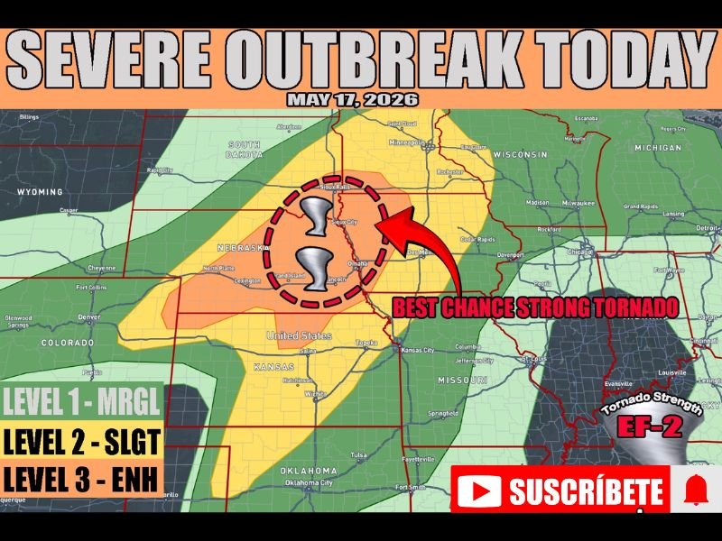
Strong EF2 Tornadoes Most Likely Across Eastern Nebraska and Western Iowa Core Zone
The dashed red circle centered over the Grand Island, Omaha, Sioux City, and Sioux Falls corridor represents the best chance for strong EF-2 tornado development today. The atmospheric environment across this zone provides the instability and wind shear needed to support violent and long-track tornado potential during the afternoon and evening hours.
Some uncertainty exists around storm mode, with hi-res guidance showing a possible quick linear transition that could alter how the day plays out.
Very Large Hail and Destructive Straight Line Winds Expected Alongside Tornado Threat
Beyond tornadoes, very large hail and destructive straight line winds are expected to be common hazards with today’s storms across the Enhanced and Slight Risk zones. The Level 3 Enhanced Risk covers the primary tornado corridor while Level 2 Slight and Level 1 Marginal zones fan outward through Kansas, Missouri, Wisconsin, and Michigan.
Any storm developing within the Enhanced Risk zone today should be treated as immediately life-threatening.
Multiple Ways to Receive Warnings Essential Before Storms Arrive This Afternoon
Residents across eastern Nebraska, western Iowa, and the Sioux Falls area must have weather radios and phone alerts active before storms develop this afternoon. A quick storm mode transition could compress warning times significantly, making advance preparation the difference between safety and serious danger today. Stay with NapervilleLocal.com for the latest weather updates and local forecast coverage.

I’ve lived in Naperville long enough to see how quickly our community changes — from new developments downtown to sudden shifts in our Midwest weather. Reporting on Naperville news and daily forecasts gives me the chance to keep neighbors informed about what really matters. My goal is simple: deliver clear, timely updates so you always know what’s happening in our city and what to expect from the skies above.