
Severe Weather Returning to Illinois and the Plains Thursday April 23 With Overnight Risk Possible for Chicago, Rockford, and Aurora
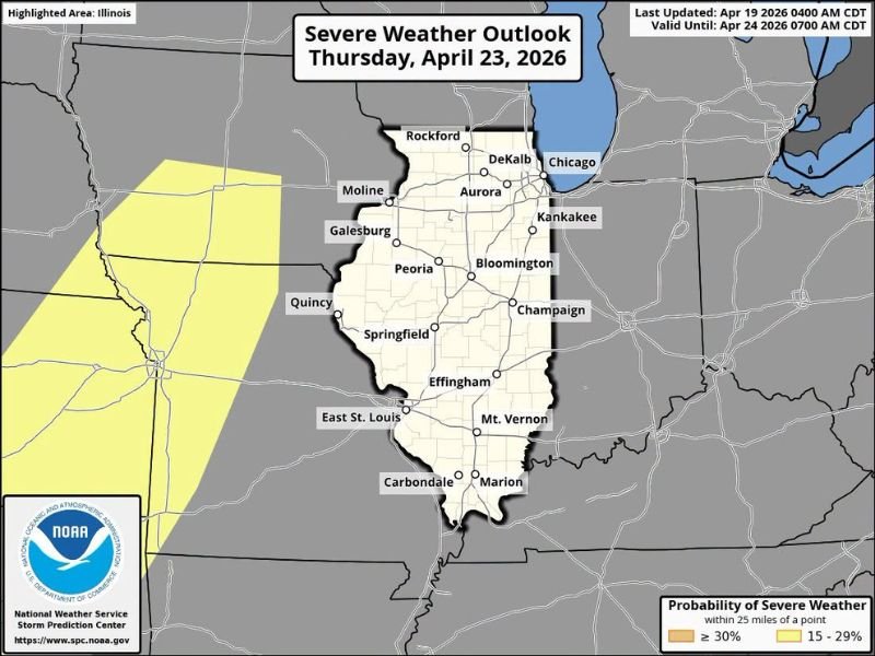
ILLINOIS — Severe weather is likely returning to Illinois and the broader Plains and Midwest region next Thursday, April 23, 2026, with the threat potentially arriving as an overnight risk for much of the state. The Severe Weather Outlook issued by the National Weather Service Storm Prediction Center highlights Illinois with a 15 to 29% probability of severe weather within 25 miles of any point across the state, with a higher 30% or greater probability zone already developing just to the west across the Plains corridor.
Overnight Timing Adds Extra Concern for Illinois
One of the most significant aspects of Thursday’s developing severe weather threat is the potential overnight timing for Illinois. Overnight severe weather events are particularly concerning because they occur when many residents are asleep and less likely to receive or respond to warnings in a timely manner.
Residents across the entire state from Rockford and Chicago in the north through Springfield, Peoria, and Bloomington in the center down to Carbondale and Marion in the south should have weather alert systems active and capable of waking them during the overnight hours heading into Thursday night.
Entire State of Illinois Falls Within the Outlook Area
The Severe Weather Outlook valid through April 24, 2026 places the entire state of Illinois within the highlighted risk area. Every major community across the state including Chicago, Rockford, DeKalb, Aurora, Kankakee, Moline, Galesburg, Peoria, Bloomington, Champaign, Quincy, Springfield, Effingham, East St. Louis, Mt. Vernon, Carbondale, and Marion all fall within the outlined severe weather probability zone.
The broad coverage of the outlook across all of Illinois means that no area of the state should consider itself safely out of the picture for Thursday’s returning threat.
Higher Risk Zone Already Developing to the West
A 30% or greater probability zone is already outlined just west of Illinois across the Plains corridor, indicating that the most intense severe weather is expected to originate further west before tracking eastward into Illinois during the Thursday evening and overnight hours. This western origin is consistent with the typical progression of Plains-driven severe weather systems that impact Illinois during peak spring storm season.
As the system moves east and encounters the instability and wind shear in place across Illinois, storm organization and intensity will determine the ultimate severity of Thursday night’s threat for the state.
Begin Preparing Now for Thursday Night
With nearly four days remaining before Thursday’s threat arrives, residents across Illinois have valuable time to prepare properly. Ensure weather alert apps and NOAA weather radios are functioning and set to wake you during overnight warnings, identify interior shelter locations in your home, and stay tuned to updated forecasts as the week progresses and confidence in Thursday’s threat increases. Stay with NapervilleLocal.com for the latest weather updates and local forecast coverage.

I’ve lived in Naperville long enough to see how quickly our community changes — from new developments downtown to sudden shifts in our Midwest weather. Reporting on Naperville news and daily forecasts gives me the chance to keep neighbors informed about what really matters. My goal is simple: deliver clear, timely updates so you always know what’s happening in our city and what to expect from the skies above.