
Damaging Winds, Large Hail, and Tornadoes Likely Statewide Across Arkansas Friday in Multi-Round Severe Weather Event From Morning Through Evening
ARKANSAS — Severe weather is likely across the entire state of Arkansas this Friday, with every county highlighted under a severe outlook as a multi-round storm event unfolds from the first half of the day through mid to late afternoon and into the evening hours. Damaging winds and large hail are the primary concerns, though tornadoes will also be possible given the late April atmospheric setup. The morning round is expected to be more widespread while the afternoon and evening activity may be more isolated or scattered across the state.
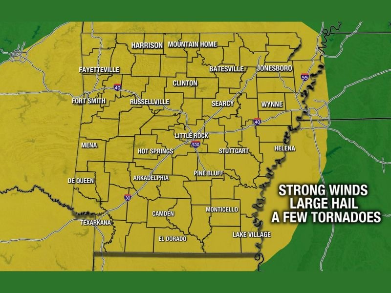
Every County in Arkansas Under Severe Outlook for Friday
The Arkansas Weather Network Severe Outlook for Friday shows the entire state covered under a Low risk designation, with every county from Fayetteville and Fort Smith in the northwest through Little Rock, Jonesboro, and Helena in the east and down through Texarkana, El Dorado, and Lake Village in the south all included in the outlined risk area.
The uniform statewide coverage means no area of Arkansas can consider itself safely out of the picture for Friday’s severe weather potential regardless of location within the state.
Multi-Round Setup Spans Morning Through Evening
Friday’s severe weather setup is particularly notable for its multi-round nature. The morning round is expected to be the more widespread of the two, potentially impacting a broader geographic area across the state during the first half of the day.
The afternoon and evening round is then expected to be more isolated or scattered in nature but could still produce significant severe weather impacts across portions of the state during the mid to late afternoon and evening hours. Residents should remain weather aware not just during the morning hours but throughout the entire day and into the evening.
Damaging Winds and Large Hail Lead the Threat List
Forecasters are identifying damaging winds and large hail as the two primary hazards for Friday across Arkansas. These threats will be present with both the morning widespread round and the afternoon and evening scattered activity, meaning the window for wind and hail impacts extends across a very long portion of the day.
Tornadoes will also be possible, particularly given the late April timeframe when atmospheric conditions across Arkansas are historically favorable for tornado development. Forecasters note that with late April setups anything is possible in terms of severe weather mode and intensity.
More Defined Forecast Expected Before Friday Arrives
The current statewide Low risk designation is expected to be refined with a more detailed and specific forecast before Friday arrives. Forecasters anticipate that confidence in exact timing, primary impact areas, and hazard specifics will increase significantly over the next day or two as the system comes into clearer focus on model data.
Residents across Arkansas should stay tuned to updated forecasts and have all severe weather preparedness measures in place well before Friday morning’s first round of storms arrives. Stay with NapervilleLocal.com for the latest weather updates and local forecast coverage.

I’ve lived in Naperville long enough to see how quickly our community changes — from new developments downtown to sudden shifts in our Midwest weather. Reporting on Naperville news and daily forecasts gives me the chance to keep neighbors informed about what really matters. My goal is simple: deliver clear, timely updates so you always know what’s happening in our city and what to expect from the skies above.