
Stronger Storms With Gusty Winds Possible Across the Southeast Including Atlanta, Charlotte, Jacksonville, and Tampa as Warmer 80s Fuel Stronger Individual Cells Wednesday
SOUTHEASTERN UNITED STATES — Wednesday’s storm pattern across the Southeast will be notably different from the last couple of days, with fewer storms overall but warmer temperatures pushing into the 80s giving any cell that does develop access to more energy and the potential to produce stronger gusty winds.
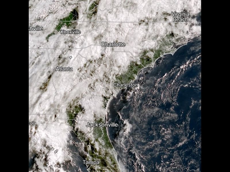
Satellite imagery shows broad cloud cover blanketing the region from Knoxville and Atlanta eastward through Charlotte, Charleston, and down through Jacksonville and Tampa, with scattered lightning activity already visible across the Florida zones.
Fewer Storms Expected Wednesday but Any Cell That Forms Could Pack Stronger Winds
The key distinction for Wednesday’s forecast is quality over quantity, with storm coverage expected to be less widespread than recent days while individual cells that do develop tap into warmer atmospheric energy to produce stronger wind gusts. Gusty winds are identified as the primary concern with any storm that forms across the Southeast through the afternoon and evening.
The warmer temperature profile with many areas reaching into the 80s provides more instability for any storm that does manage to organize compared to the cooler and more widespread storm pattern of the prior days. Residents should not interpret fewer storms as a safer day if a strong cell develops nearby.
More Dry Time Expected Wednesday With Broader Coverage Than Prior Days Breaking Down
Wednesday will feature more dry time across the broader Southeast corridor compared to the relentless and widespread coverage of recent storm days. The overall storm footprint will be smaller and more isolated, meaning a larger percentage of communities will stay dry through most of the day before any afternoon development begins.
Satellite imagery confirms broad cloud cover across the region but with less organized convective activity compared to the prior days of heavy and widespread rainfall. The reduced storm coverage is a relative improvement for the Southeast even if individual storm intensity potential has increased with the warmer temperatures.
Staying Weather Aware Remains Important as Gusty Wind Threat Persists Through Wednesday
Despite fewer storms in the overall pattern, the gusty wind threat from any cell that does develop means Wednesday still requires weather awareness across the entire region from Atlanta through Charlotte and down through the Florida peninsula. Any outdoor afternoon plans across the Southeast should include a weather contingency given the potential for quick-hitting gusty storm development through the day. Stay with NapervilleLocal.com for the latest weather updates and local forecast coverage.

I’ve lived in Naperville long enough to see how quickly our community changes — from new developments downtown to sudden shifts in our Midwest weather. Reporting on Naperville news and daily forecasts gives me the chance to keep neighbors informed about what really matters. My goal is simple: deliver clear, timely updates so you always know what’s happening in our city and what to expect from the skies above.