
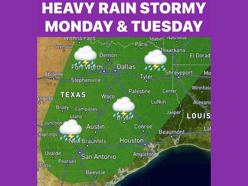
Heavy Rain and Flash Flooding Threat Targeting Texas Including Dallas Fort Worth Houston Austin and San Antonio With Widespread Storms Monday Into Tuesday
TEXAS — Heavy rain and stormy conditions are headed for Texas starting Monday and intensifying through Tuesday, with widespread storms expected across a large portion of the state. A stalling front across North and East Texas on Tuesday raises the most serious concern, with rainfall rates potentially approaching 2 inches per hour and localized flash flooding possible east of DFW. Hot and dry conditions continue through Sunday before the pattern shifts dramatically heading into the new week.
Scattered Storms Begin Sunday Night Along West Texas Dryline Before Spreading East
Attention turns to a developing dryline in West Texas late Sunday, where showers and thunderstorms are expected to fire and push east toward the Metroplex overnight. North Texas could see scattered activity at around 30 percent coverage during this opening round. This sets the stage for a much more widespread and impactful storm event developing through Monday and Tuesday.
Widespread Storms Arrive Monday as Stronger Disturbance and Front Push Into Texas
Rain chances increase significantly Monday as a stronger disturbance and approaching cold front combine to drive widespread showers and thunderstorms across Texas during the afternoon and into Monday night. Dallas, Fort Worth, Houston, Austin, and San Antonio all fall within the primary storm zone during this period.
Coverage expands considerably compared to Sunday’s scattered activity, making Monday the first full widespread rain day across the state.
Stalling Front Tuesday Raises Flash Flooding Concerns East of DFW Through East Texas
Tuesday brings the highest rainfall concern as the front stalls across North and East Texas, allowing moisture to pool and rainfall rates to surge toward 2 inches per hour at times. The Tyler, Lufkin, Beaumont, and Shreveport corridor east of DFW carries the greatest flash flooding exposure Tuesday.
Anyone across North and East Texas should monitor conditions closely and avoid low-lying roadways during and after heavy rainfall periods through the week ahead. Stay with NapervilleLocal.com for the latest weather updates and local forecast coverage.

I’ve lived in Naperville long enough to see how quickly our community changes — from new developments downtown to sudden shifts in our Midwest weather. Reporting on Naperville news and daily forecasts gives me the chance to keep neighbors informed about what really matters. My goal is simple: deliver clear, timely updates so you always know what’s happening in our city and what to expect from the skies above.