
Invisible Divide Splits Ohio Rainwater Between Lake Erie and the Gulf of Mexico, Cities Like Toledo, Cleveland, Columbus and Dayton on Opposite Sides
OHIO — A hidden geographic line cuts across Ohio, determining whether a single raindrop eventually reaches the Atlantic Ocean or the Gulf of Mexico thousands of miles away. Known as a drainage divide, the boundary separates the state into two distinct watersheds with dramatically different final destinations. Rain falling just a few miles apart on either side of the line can end up in entirely different bodies of water. Many residents cross this invisible divide regularly without ever realizing it.
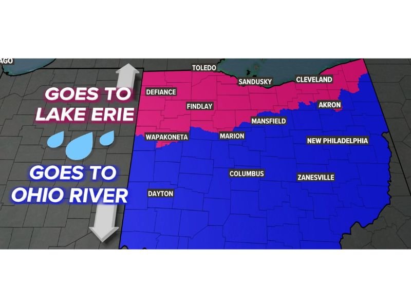
Northern Ohio Drains Into Lake Erie
Cities including Toledo, Sandusky, Cleveland, Defiance, Findlay, and Akron sit north of the divide. Rainwater falling in this region flows into Lake Erie before continuing through the Great Lakes system and eventually reaching the Atlantic Ocean by way of the St. Lawrence River.
Southern Ohio Flows Toward the Gulf of Mexico
South of the line, communities such as Wapakoneta, Marion, Mansfield, Dayton, Columbus, New Philadelphia, and Zanesville drain in the opposite direction. Rain in this part of the state makes its way into the Ohio River, then the Mississippi River, before finally emptying into the Gulf of Mexico.
A Line That Shapes the State’s Geography
The divide does not follow a straight or obvious path, instead winding through central Ohio in a way that places major cities on opposite sides of the watershed boundary. Mansfield and Marion sit close to the line, illustrating just how narrow the separation between the two drainage paths can be.
Why the Divide Matters
Watershed divides like this one play a major role in flood patterns, water management, and regional ecology, since rainfall on either side feeds entirely separate river systems. Understanding which side of the divide a community sits on can offer insight into local flood risk and how stormwater moves through the region.
Stay with NapervilleLocal.com for the latest weather updates and local forecast coverage.

I’ve lived in Naperville long enough to see how quickly our community changes — from new developments downtown to sudden shifts in our Midwest weather. Reporting on Naperville news and daily forecasts gives me the chance to keep neighbors informed about what really matters. My goal is simple: deliver clear, timely updates so you always know what’s happening in our city and what to expect from the skies above.