
Less Hot More Active Pattern Brings Daily Storm Chances to Colorado Including Eastern Plains and Front Range This Week Starting Sunday
COLORADO — A shift toward a less hot and more active weather pattern is settling into Colorado this week, bringing daily chances for scattered showers and thunderstorms across most of the state. The Western Slope remains the exception, staying warm and mostly dry before temperatures drop back into the 80s starting Monday. Storm coverage will be hit or miss each day, with the greatest risk along and east of Interstate 25. A slightly elevated severe weather risk is expected Monday on the eastern plains as a cold front approaches.
Eastern Plains Face Strongest Storm Risk This Week
The eastern plains of southern Colorado and western Kansas will see the warmest temperatures, ranging from the 80s to mid 90s, along with the best chance for strong to severe thunderstorms. Large hail, damaging winds, and an isolated tornado cannot be ruled out in the strongest cells, with southerly winds gusting 20 to 30 mph.
Western Slope Stays Hot and Dry Into Monday
The Hwy 50 corridor and southwest Kansas will hold onto upper 80s to upper 90s heat through the weekend before finally cooling into the 80s on Monday. Storm activity here remains limited, with mostly dry conditions and continued fire weather concerns through the period.
Mountains and Front Range See Daily Storm Chances
The mountains and Continental Divide will run coolest, with highs in the 60s to upper 70s and the most frequent storm development, including lightning, gusty winds, and pockets of heavy rain. The Front Range and I-25 corridor will see mid 80s to low 90s with hit-or-miss afternoon storms each day.
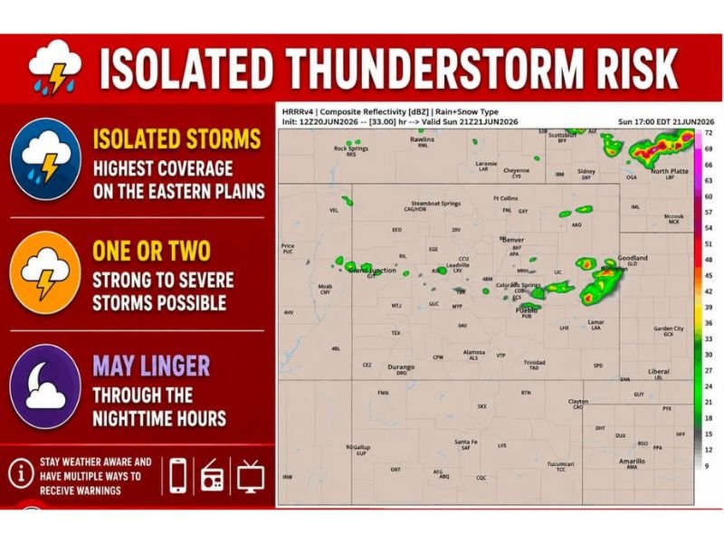
Isolated Storms Expected Sunday Before Pattern Shift
Today’s storm coverage will be fairly isolated, with convective initiation expected near or after 1 p.m. Some thunderstorm clusters may linger into the nighttime hours on the far eastern plains as a cold front approaches ahead of Monday’s slightly elevated severe risk.
Stay with NapervilleLocal.com for the latest weather updates and local forecast coverage.

I’ve lived in Naperville long enough to see how quickly our community changes — from new developments downtown to sudden shifts in our Midwest weather. Reporting on Naperville news and daily forecasts gives me the chance to keep neighbors informed about what really matters. My goal is simple: deliver clear, timely updates so you always know what’s happening in our city and what to expect from the skies above.