
Oklahoma Weather Whiplash as Freeze Hits Monday Morning Before 90s and Possible 100° Heat Surge Across Western Oklahoma
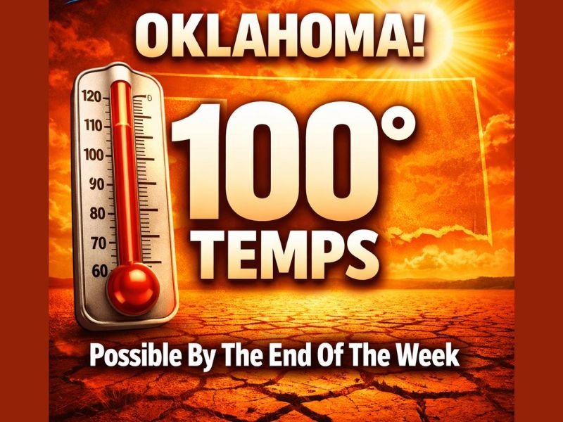
OKLAHOMA CITY, OKLAHOMA — Oklahoma residents are facing an extraordinary weather turnaround this week as a hard freeze early Monday morning is expected to give way to near-summer heat by late next week. Forecast guidance shows temperatures potentially surging into the 90s statewide and even approaching 100 degrees in parts of western Oklahoma, marking one of the most dramatic spring weather swings of the season.
Meteorologists say the sudden shift is being driven by a major atmospheric pattern change across the central United States. A strong upper-level ridge is expected to build over the western and central portions of the country late next week, allowing very warm air to surge northward across the Plains.
Freeze Monday Morning Signals the Start of a Dramatic Shift
The week will begin with a very different story. Early Monday morning, temperatures across Oklahoma are expected to plunge below freezing in several areas, creating frost and freeze concerns for early vegetation and agriculture.
Cold overnight conditions will mark the final push of a departing winter-like air mass. However, the chill will not last long. Once the cold system exits, a rapid warming trend is expected to take over across the region. Forecasters describe this setup as a classic Plains “weather whiplash” scenario, where dramatic temperature swings occur within just a few days.
Late-Week Heat Could Approach 100 Degrees in Western Oklahoma
As the high-pressure ridge strengthens later in the week, temperatures are forecast to climb sharply across Oklahoma.
Weather guidance suggests:
- Temperatures in western Oklahoma could approach or exceed 100 degrees
- Much of the state is likely to see highs in the 90s
- Several consecutive days of widespread 90-plus temperatures are possible
If those projections hold, some locations could challenge near-record warmth for late March, which would be highly unusual for this time of year. Such rapid warming can create additional concerns for residents who are still experiencing cold overnight conditions earlier in the week.
Dry Pattern Raises Drought and Fire Concerns
Along with the heat, forecasters warn that the upcoming pattern appears very dry across Oklahoma and much of the central Plains. Weather models currently show little to no rainfall over the next 7 to 10 days, which could worsen existing drought conditions in parts of the region.
Dry air combined with hot temperatures and increasing spring winds can also raise wildfire danger, particularly across western Oklahoma where vegetation may already be stressed. Fire officials typically monitor these patterns closely because sudden heat waves during dry periods can rapidly increase the risk of grassfires.
A Classic Oklahoma Spring Weather Swing
The expected shift from freezing temperatures to near-triple-digit heat in just a matter of days highlights the unpredictable nature of spring weather across Oklahoma.
Residents could experience frosty mornings early in the week followed by conditions more typical of early summer before the week ends. Meteorologists continue monitoring the evolving pattern to determine exactly how intense the late-week heat becomes and whether any temperature records may be threatened.
For now, the forecast tells a clear story — freeze conditions Monday morning followed by a rapid warm-up that could bring widespread 90s and even 100-degree heat across parts of Oklahoma by the end of the week. Stay with NapervilleLocal.com for continuing weather updates, national climate developments, and breaking forecasts impacting communities across the United States.

I’ve lived in Naperville long enough to see how quickly our community changes — from new developments downtown to sudden shifts in our Midwest weather. Reporting on Naperville news and daily forecasts gives me the chance to keep neighbors informed about what really matters. My goal is simple: deliver clear, timely updates so you always know what’s happening in our city and what to expect from the skies above.